The short answer
Chiang Mai to Nan is 328 km by the fast road through Lampang and Phrae, or 381 km the way riders go — round through Chiang Kham onto Route 1148, 113 km of mountain highway voted the best road in Northern Thailand.
The tour that rides Phu Chi Fa and Nan: Rider's Paradise (6 days, 5 nights) · or ask us on WhatsApp
Mae Hong Son and Nan in one ride: NBT Super Loop (11 days, 10 nights)
NAN AT A GLANCE
- Chiang Mai → Nan
- 328 km the fast way · 381 km via Route 1148
- Route 1148
- 113.079 km · Tha Wang Pha ↔ Chiang Kham
- How it ranks
- Voted the #1 road in Northern Thailand
- The loop from Nan town
- 203 km · Pua, Bo Kluea, Santi Suk
- Fuel on the 1148
- Longest gap 18.7 km · 78.7 km between branded stations
- Nan → Phu Chi Fa
- 219 km · about 5 h 30 · a full day
- Best months
- November to February · December and February driest
- Worst months
- June–September (August the wettest) · February–April (smoke)
- Difficulty
- Sealed, wide, well-cambered. Long rather than technical.
- Ride each day by
- Daylight. The 1093 up to Phu Chi Fa is unlit.
Road status — a snapshot, not a promise
AS OF 25 AUGUST 2026
On 18–19 August 2026 a rain bomb landed on Pua district, north of Nan, and the valley flooded. Three weeks later some of it was still not fixed. This is what the highway bulletins said on the date at the top of this box, and it is why we are not writing any of it as a permanent fact.
- Route 1256, Pua to Bo Kluea. The bridge at km 5+975 was destroyed. The last bulletin we have read, dated 25 August 2026, has km 8+700 — the Huai Yen curve — passable by ambulances and urgent vehicles only, with the signposted detour to Bo Kluea running the long way round on Route 1081. We have no later bulletin than that.
- Route 1148, at km 73+250. A landslide closed it on 13 August 2026. The 25 August 2026 bulletin says thirteen of fourteen damaged sites across seven highways were back in use but does not list them individually, so we treat the 1148’s reopening as likely and unconfirmed rather than telling you it is fine.
There is no live road-status feed for these highways, which is exactly why this box carries a date instead of a verdict. The Department of Highways hotline is 1586 — worth a call before committing to this ground in the wet months, whoever you ride with. Or ask us what we’re hearing.
WHY RIDERS SAY NAN
There is a community poll of the best roads in Northern Thailand that riders here have been pointing at for over a decade. The interesting thing is not the winner. It is that every one of the top five roads is in Nan province — the 1148 first, then the 1091, the 1256 over Doi Phu Kha, the 1081 and the 1080.
Five out of five, in a province most visitors have never heard of, chosen by people who ride the whole North. Mae Hong Son is the famous one and deserves to be. Nan is the one riders keep going back to, and the reason is simple arithmetic: it is far enough east to be off the tourist track, and the roads were built through mountains rather than around them.
It is also a corridor whose information has quietly rotted. Of the guides we checked before writing this, several are gone, one domain no longer resolves, and not one had the length of the headline road right. That is the gap this page is here to close.
FOUR WAYS TO GET THERE
Chiang Mai to Nan is not one journey, it is a choice, and the choice is worth more thought than the map suggests. All four below are measured door to door, old city to Nan town, with the extra time this terrain actually takes added on top of the routing engine’s figure.
| Route | Roads | Distance | Riding time | Character |
|---|---|---|---|---|
| The fast road | 11 → 127 → 11 → 101 | 328 km | 6–7 h | Lampang, Den Chai, Phrae. Four-lane and open. It gets you there; it is not the reason you came. |
| Via Phayao and the 1091 | 118 → 120 → 1 → 1021 → 1251 → 1091 → 101 | 300 km | 7–8 h | Shortest in kilometres, longest in time — and that inversion is the whole tell. The 1091 is a mountain road. |
| The riding road | 118/120 → 1 → 1021 → Chiang Kham → 1148 → 101 | 381 km | 9–10 h · two days | 53 km and about three hours longer than the fast road. The 1148 is the point of the whole trip. |
| Via Chiang Rai, then the 1148 | 118 → 1 → Chiang Rai → 1021 → 1148 | 446 km | Two days | Only if you were taking in Chiang Rai's temples anyway. |
The row worth staring at is the second one. Going via Phayao and the 1091 is the shortest way to Nan — 300 km against 328 — and also the slowest. When a route is 28 km shorter and an hour longer, the map is telling you something about the terrain that the distance alone hides. The 1091 is a mountain road, and it is second on that top-five list.
ROUTE 1148 — HOW LONG IS IT, REALLY?
Route 1148 is 113.079 km long — kilometre post 0+000 at the Highway 101 junction in Tha Wang Pha, kilometre post 113+079 at Ban Yuan on the Chiang Kham side. We checked it four ways before printing it: the Department of Highways register, the department’s own kilometre-marker table, an independent sum of the mapped road (113.5 km) and a routing trace end to end (113.2 km). Four methods, one answer.
You will also see other figures for this road — 91 km is the common one, and 70 and 120 turn up too. The 91 is a genuine measurement of a shorter stretch, between two intermediate junctions rather than the full highway, and the difference is worth knowing about for one practical reason only: fuel and daylight. If your plan assumes 91 km end to end, add 22.
WHAT IT IS ACTUALLY LIKE
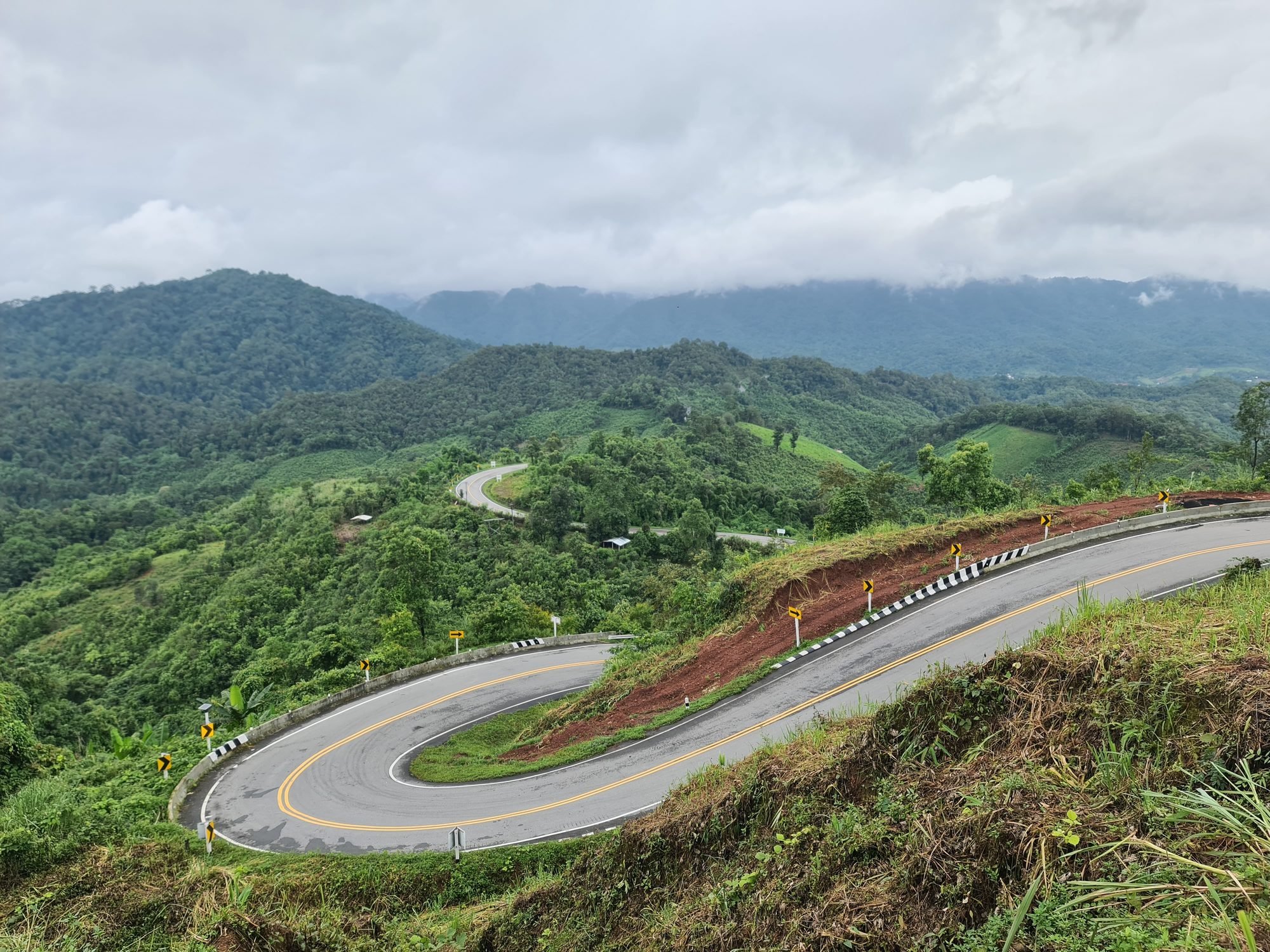
Sealed the whole way — there is no unpaved section of the 1148 in current map data, and the most recent rider report we could find describing the surface, from 2023, calls it good. It climbs and drops continuously between the Nan valley and the Phayao plain, which is what the riders who vote for it mean when they call it a roller coaster.
Ban Pha Lak sits at the midpoint, 45 km from either junction, with a village shop — the natural half-way stop in either direction, and 61 km, about an hour, from Pua. Along the way you pass the Phu Langka ridge near the Chiang Kham end and the Iu Mien village of Ban Sakoen in the middle.
Which direction? Nobody has published an answer, including the thread that asks the question and then leaves it hanging. Here is our reasoning rather than a fact: the Nan end is the flatter end, so riding east to west — Tha Wang Pha towards Chiang Kham — front-loads the easy kilometres and puts the sustained mountain work in the middle, finishing on the plain. Ride it the other way and you finish on the hardest part. Neither is wrong.
One thing to know for later: there is a Department of Highways project to widen part of the 1148 from two lanes to four. As of the latest documents we can see it is at survey-and-design stage with no construction date. The road riders love is on a list. It is not on a schedule.
FUEL, MEASURED
You will read that the 1148 has no fuel and no villages on it. That is the other thing this road gets wrong in print. We pulled every mapped fuel point in the corridor and measured how far along the road each one sits, and then found a rider who had bought fuel at one of them. Here is what is actually true.
Any fuel at all
Longest gap 18.7 km
Nine fuel points sit on the 1148. It is not the empty road it is described as.
Branded stations
Gap of 78.7 km
Bangchak at km 29 to PT at km 108. In between: village pumps and minipumps. No cards, no guaranteed hours.
Route 1256, over Doi Phu Kha
39 km with nothing
Both ends have fuel — Pua and Bo Kluea. Fill at whichever end you start from and the gap stops mattering.
Phu Chi Fa village
No station within 8 km
Arrive full. Nothing up there opens early enough for a pre-dawn start anyway.
So the honest sentence is not “there is no fuel”. It is that range is not the problem here — octane, opening hours and payment are. Any modern motorcycle covers 113 km on a tank without thinking about it. What you do not want is to plan on buying fuel in the middle of the 1148 and find a drum and a hand pump with nobody home. Fill in Tha Wang Pha or Chiang Kham, ride the road on a full tank, and the whole question disappears.
THE NAN LOOP, LEG BY LEG
Getting to Nan is half of it. The other half is the circuit out of Nan town that most riders come for: north on the 101 to Pua, over Doi Phu Kha to the salt wells at Bo Kluea, then the long way back down the 1081. 203 km, and a full day — read the times, not the distances.
| Leg | Road | Distance | Character |
|---|---|---|---|
| Nan → Pua | 101 | 60 km | The easy hour. Valley road, fuel and food all the way. |
| Pua → Bo Kluea | 1256 | 51 km | Over Doi Phu Kha. Allow two hours — it is 51 km of pass, not 51 km of road. |
| Bo Kluea → Santi Suk | 1081 | 73 km | The long ridge run. Two to two and a half hours. |
| Santi Suk → Nan | 1169 | 16 km | Twenty-five minutes home. |
ROUTE 1256 — OVER DOI PHU KHA
Officially 46.596 km, Pua to Bo Kluea, and third on that top-five list. It is the shortest road on the loop and the one that takes longest, because it is a pass rather than a road with hills on it.
We are not going to tell you what its surface is like today. Reports on this one road have contradicted each other for well over a decade — the same stretch called immaculate and broken-edged in the same season — and after the August 2026 flood the honest answer is even less settled than usual. Treat the 1256 as the road on this loop where you slow down, and read the dated box at the top of this page before you plan a day around it.
If you are here in February or March, the Chomphu Phukha tree the road is named for stands about 30 km up the hill from Pua beside the shrine. It flowers for roughly a fortnight a year and then stops, which is a good description of Nan generally.
ROUTE 1081 — BO KLUEA AND THE SALT WELLS
The 1081 is 157 km of highway on paper — the long north–south spine of eastern Nan, running all the way to the Lao border at Huai Kon. The section riders mean when they say “the 1081” is the 73 km from Bo Kluea down to Santi Suk, and it is fourth on the list. Allow two to two and a half hours; it does not let up.
Bo Kluea means “salt wells”, and that is not decoration: they are inland mountain brine wells, hundreds of kilometres from any sea, worked for centuries and still worked now. It is the reason the district exists.
We have deliberately not printed opening hours or a fee for the wells. We could not verify either, and after the flood we would not trust a pre-August answer anyway. Ask when you are in Pua.
WHERE YOU SLEEP
Nan town has a hundred-plus places to stay and you do not need to book far ahead outside December and January. Pua has a real choice but a small one — book it in the cool season. Bo Kluea is the bottleneck: a handful of listings for the loop’s natural overnight stop. If your plan depends on sleeping there, book it first and build the rest of the trip around it. We have not printed prices on this corridor because no 2025–26 price we found held up to checking.
PHU CHI FA
The cliff-edge viewpoint over the Mekong plain sits in eastern Chiang Rai, on the Lao border, and it is the one thing on this corridor that a Nan trip is routinely built around. It is also, oddly, missing from every Nan route guide we fetched — which is why the first number below does not exist anywhere else.
Nan to Phu Chi Fa is 219 km and about five and a half hours. A full day, not an afternoon. The route runs the 101 north, onto the 1148 as far as Chiang Kham, then the 1021, the 1222 and finally the 1093 — the border ridge road, which is the one that actually climbs the mountain. The 1148 is the connector on that day, not the access road, and it is worth saying because plenty of people assume otherwise.
On our own tours Phu Chi Fa is a night, not a stop. On Rider’s Paradise it comes up from Chiang Khong on the Mekong — 73 km, about an hour and three-quarters of riding — and the next day runs 186 km down to Pua, about four and three-quarter hours. The NBT Super Loop arrives from Chiang Rai instead, 84 km, and rides the same Phu Chi Fa to Pua day.
TWO ACCESS RULES NOBODY WRITES IN ENGLISH
- A standing annual closure, 1 July to 31 August. Visiting and staying at the summit viewpoint stop for those two months. It has been the same two dates in the years we could confirm, which is what makes it a rule rather than an incident.
- On peak dates in December and January, you cannot ride up for sunrise. Private cars and motorcycles are banned from the summit road between 04:30 and 09:00 on the listed dates; everyone parks below and takes a community shuttle from one of seven pick-up points. The park’s stated reason is the steep grade of the ascent and the lack of parking at the top. The listed dates for the last season clustered on December weekends, over New Year and into mid-January.
We are not going to tell you the state of play on the day you read this. No notice for the coming season has been published that we can verify, the peak-date rule has to be assumed to return, and this is precisely the sort of detail that turns a 05:00 alarm into a wasted morning. The park answers its phone — a call ahead is the only reliable way to know, whoever you ride with.
THE SUNRISE, IN NUMBERS
Most pages say “around 6:30 in winter”. That is right for early December and roughly twenty minutes out by the middle of January, which is the difference between arriving early and standing on an exposed ridge in the dark for an hour. These are computed for the viewpoint’s own coordinates.
| Date | First light | Sunrise |
|---|---|---|
| 1 December 2026 | 06:13 | 06:35 |
| 21 December 2026 | 06:24 | 06:47 |
| 15 January 2027 | 06:32 | 06:54 |
- The walk is 700 to 760 m from the main car park and takes twenty to thirty minutes, steep at the end. If you see 1.5 km quoted, that is measured from the village below, not from the car park. Start walking forty to sixty minutes before the sunrise time above — not at 05:00.
- It is colder than anyone tells you. The January average daily minimum up there is 10.9 °C and December’s is 11.4 °C — five to six degrees below Nan town on the same night. You leave a warm valley and stand still on an exposed ridge before dawn. Bring the jacket you think you will not need.
- Sleep at the mountain. Chiang Rai is two to two and a half hours away, so a sunrise day-trip means a 03:00 start on an unlit mountain road. The villages below the trail have simple guesthouses, homestays and campsites — and no cash machines. Bring cash, and book for December and January.
What we have not printed: an elevation, an entrance fee or a shuttle fare. The elevation figures in circulation disagree by nearly 200 m and no source reconciles them; the fee most English pages quote belongs to a different viewpoint 20 km away. When we can verify them, they will appear here.
WHEN TO RIDE IT
Ten-year monthly rainfall means for the three places on this route that decide whether a trip works. Millimetres per month.
| Month | Nan town | Pua | Phu Chi Fa |
|---|---|---|---|
| Nov | 56 | 56 | 107 |
| Dec | 15 | 15 | 48 |
| Jan | 27 | 22 | 52 |
| Feb | 16 | 15 | 31 |
| Mar | 25 | 17 | 33 |
| Aug | 423 | 405 | 446 |
November to February — ride it. Cool, dry and clear, with December and February the two driest months of the year here. It is also when the sea of mist at Phu Chi Fa is worth getting up for, and when the beds in Bo Kluea and below the viewpoint fill up.
February to April — the roads are fine, the views are not. Nan is one of the provinces worst hit by the northern burning season. Nothing about the riding gets harder. But the 1148, the 1256 and Phu Chi Fa are all bought with your eyes, and a sea of mist you cannot see through smoke is a five o’clock alarm for nothing. If March is all you have, ride the roads and skip the viewpoints.
June to September — and August above all. August is the wettest month everywhere on this route: around 400 mm at Pua and 450 mm at Phu Chi Fa, falling on most days of the month. That is not a statistic, it is the explanation for the box at the top of this page — the flood that cut the 1256 happened in the month the numbers say it would. October is the shoulder: the rain has dropped sharply, but the mountains are still shedding water.
HOW TO RIDE IT WITH US
Nan is a long way from Chiang Mai and the roads that make it worth the distance are the ones with the least around them. That is a good argument for going with someone who has ridden them, and an even better one this season, with a flood-damaged pass and a viewpoint whose access rules change without an English-language announcement.
If you have never ridden a Thai mountain road before, do not start here. Ride the Samoeng Loop first, or the Mae Hong Son Loop, and come east once the corners have stopped being a problem. Licence and insurance detail is on our Before You Ride page.
WITH A GUIDE
Rider’s Paradise — six days out of Chiang Mai through Chiang Rai, Phu Chi Fa and Nan, with a guide who rides these roads every season.
ON YOUR OWN
Your ride, your pace — with a route sheet and a number that answers when you are five hours from Chiang Mai.
ON THE BACK
You do not have to ride to see these roads. No licence, no experience, the same corners.
CHIANG MAI TO NAN FAQ
How far is Chiang Mai to Nan by motorbike?
About 328 km by the fast road — Highway 11 and 101 through Lampang, Den Chai and Phrae — which is six to seven hours of realistic riding and one long day. The route riders actually come for is 381 km: north to Phayao and Chiang Kham, then east onto Route 1148 and down into the Nan valley. That one is nine to ten hours of real riding and should be split over two days.
How long is Route 1148?
We measure it at 113.079 km, from the Highway 101 junction at Tha Wang Pha to Ban Yuan near Chiang Kham — the Department of Highways kilometre posts, an independent map sum and a routing trace all land on the same figure. Other lengths in circulation (91 km is the common one) generally measure a shorter stretch between intermediate junctions, so plan fuel and daylight on the full 113.
Is there fuel on Route 1148?
Yes — nine fuel points sit on the road, and the longest gap between any two of them is 18.7 km. The real gap is a different one: 78.7 km between branded stations, from the Bangchak at km 29 to the PT at km 108. Everything in between is a village pump or a minipump — no cards, no guaranteed hours. Fill up in Tha Wang Pha or Chiang Kham and ride the road on a full tank.
How far is Nan to Phu Chi Fa on a motorbike?
219 km, about five and a half hours. It is a full day, not an afternoon. The route runs Highway 101 north, onto Route 1148 to Chiang Kham, then the 1021, the 1222 and finally the 1093 — the Lao-border ridge road that climbs the mountain. The 1148 is the connector on that day, not the access road.
Is Phu Chi Fa closed at any time of year?
There is a standing annual closure from 1 July to 31 August — confirmed by the park authority in 2022 and again in 2025, the same dates both times. Separately, on listed peak dates in December and January, private cars and motorcycles are banned from the summit road between 04:30 and 09:00 and everyone goes up by community shuttle; the reason the park gives is the steep grade and limited parking. We do not publish whether the viewpoint is accepting visitors on any given day — no 2026 notice has been issued that we can verify — so we phone the park before a departure.
When is the best time to ride to Nan?
November to February, and December and February are the two driest months on this route. Avoid June to September: August is the wettest month everywhere on the corridor, with roughly 400 mm at Pua and 450 mm at Phu Chi Fa in a ten-year average, and it is the month the roads here get cut. February to April is the northern burning season and Nan is one of the worst-affected provinces — the roads are unchanged, but the viewpoints you rode up for are the thing you lose.
How many days do you need to ride to Nan and back?
The riding road out is nine to ten hours of real riding, so two days. The classic loop out of Nan town — Pua, over Doi Phu Kha to Bo Kluea, back down the 1081 — is 203 km and a full day on its own. Add the return and a round trip from Chiang Mai that actually rides the 1148 is a five- to six-day trip. It is not a weekend.
Can I see the Nan roads as a passenger if I don't ride?
Yes. Everything on this page can be ridden pillion — no licence, no experience, the same roads. It is the most-asked question we get about the long routes and the one a rental shop cannot answer, because a rental shop can only rent you a bike.
Highway lengths are Department of Highways figures, cross-checked against mapped road data and our own routing. Distances between towns are measured door to door and carry a realistic riding-time allowance on top of the engine time. Rainfall and temperature are ten-year means, 2016–2025. Sunrise times are computed for the viewpoint’s own coordinates. Road status carries the date it was checked, at the top of this page, and nothing else on this page should be read as a current road condition.
When are you thinking of coming?
Tap a month. We'll tell you what the road is like then — no form, no sign-up.
Every month in one list
- January · Cool-dry season
- January sits right inside the cool-dry season — dry roads, crisp mountain air and the longest views of the year. It is the month we point riders with two spare weeks at, because the dry mountain roads are at their very best. Roll over the high ridges after about 09:00 and you get the valleys below with the morning mist just lifting off them.
- February · Cool-dry season
- February opens with the best of the cool season still in full swing — cold mornings in the hills, clear ridgelines and every road open. The first half of the month is a favourite with riders who want the big views, and we plan every day of the trip around getting you onto the ridgelines at their best.
- March · Hot season
- March is the start of the hot season — long warm days, dry roads, and a relaxed pace built around early starts in the cool of the morning. It is also the tail of the field-burning months, so some days are hazy and the long valley views aren't a promise. What March does beautifully is a shorter, sharper ride: a day loop out of Chiang Mai through the hills, lunch somewhere shady, and back to town before the afternoon heat. Tell us your dates and we'll shape the route to that week.
- April · Hot season · Songkran 13–15
- April is Thailand at its most alive. Songkran falls on 13–15 April and turns every town into a joyful, friendly water fight — one of the great festival experiences anywhere in Asia. Pair a few days of riding either side of it with the celebrations in Chiang Mai, and you get the roads and the festival in one trip.
- May · The first rains
- The first rains arrive and the whole north turns green almost overnight. Mornings are the riding window, the air is freshly washed, and the roads are about as quiet as they ever get. Genuinely underrated: green hills, fresh air, and the switchbacks nearly to yourself.
- June · Green season
- Green season proper — lush jungle, washed air, and fewer riders out than almost any month of the year. Mornings are made for riding and afternoons for a long lunch while the rain passes. We build the trip with flexible days, so you ride the best of every morning.
- July · Green season
- The landscape at its most dramatic — deep green valleys, mist in the mountains and waterfalls in full flow. The 762 bends on the Pai road are a different ride entirely in the green season, and a guide riding in front of you makes every one of them a pleasure. Bring proper rain gear and enjoy a side of the north most visitors never see.
- August · Green season
- August is the north at its greenest, with rice fields glowing and the hills alive. It is a month for a relaxed trip with spare time built in — ride the mornings, take the long way when the weather is kind, and slow down for coffee in the hills. Tell us your dates and we will shape the trip around the best riding of each day.
- September · Late green season
- The rain eases through September and the rice terraces are as green as they get all year — some of the most beautiful riding scenery of the whole calendar. The roads are quiet and the countryside is at its most photogenic. A flexible trip gets the very best of it.
- October · The golden shoulder
- The rains fade through October, the hills are still green, and the roads are wonderfully empty — late October is one of the best-value weeks of the year to be on a bike here. It is a lovely time for the Pai road.
- November · Cool-dry season · the best month
- The cool-dry season opens around mid-November and this is the single best month of the year to ride Northern Thailand: fresh air, cool mornings, ridgelines you can see the whole way along. The Bua Tong sunflowers on Doi Mae U-Kho come out from about mid-month — up the spur road off Route 1263. And Yi Peng and Loy Krathong fall on 24–26 November 2026, the most magical week in Chiang Mai's year, when the city glows with lanterns and candlelit krathongs.
- December · Cool-dry season · peak
- Full cool-dry season — dry roads, long views, and crisp mountain air before the sun gets to work, so bring a warm layer for the early hours. Pai is at its liveliest in December and Ban Rak Thai is at its prettiest, which is exactly why rooms along the loop are worth booking early. Cross the high ridges after about 09:00 and the valleys open up below you.
SEND US YOUR PLAN
Riding it on your own? Send us your dates, how many days you have, the bike and the route you have in mind, and our team in Chiang Mai will look it over. A rider answers, not a bot.
Send us your plan on WhatsAppThe tour that rides Phu Chi Fa and Nan: Rider's Paradise (6 days, 5 nights) · or ask us on WhatsApp